Koksilah Watershed
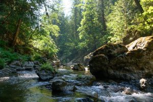 The Xwulqw'selu (Koksilah) Watershed is central to the identity of the Quw'utsun Mustimuhw.
A prominent, multi-summit ridge named Hwsalu-utsum (Koksilah Ridge), is central to Quw'utsun Origin stories. Hwsalu-utsum is where the first man, Syalutsa, fell from the sky. Hwsalu-utsum is the origin or headwaters of several tributaries that flow into the Koksilah River, including Wild Deer Creek, Kelvin Creek and Glenora Creek. [Source: koksilahwater.ca]
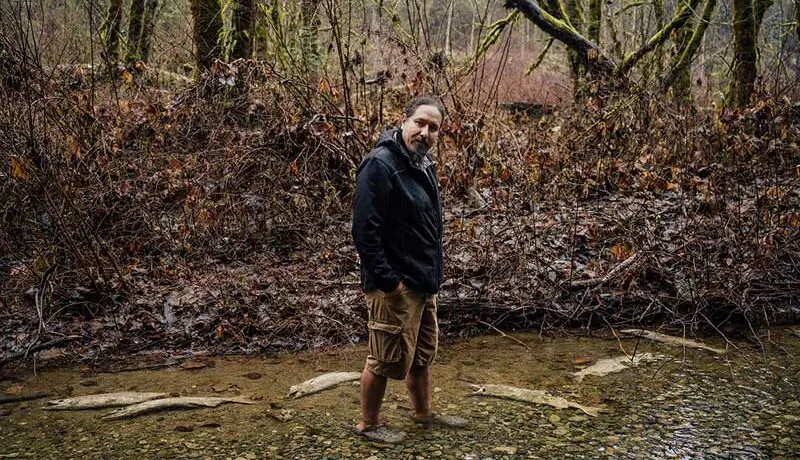
Summer flows in the Koksilah River have been exceptionally low in recent years at times when demand for water is the greatest. This threatens the survival of resident and anadromous salmonid species and the aquatic ecosystem.
In the winter, extreme flooding is an increasing issue, endangering homes in the lower watershed, and further degrading the condition of the river through erosion and loss of ecosystem diversity.
These are complex and long-standing issues arising from decades of land use decisions that did not prioritize planning for watershed health. The impacts to the river, salmon, local and indigenous food supplies, and overall community well-being affect us all, and are intensifying with climate change.
Unlike the Cowichan River, the Koksilah is an uncontrolled river (no weir) with no large lakes to store abundant winter water, nor high mountains to store water as snow pack, to moderate summer dry periods. As such, there are limited options available to manage flows other than changing our current practices around land use (including forestry, agriculture, housing, roads, industry, storm-water management, etc.) and water use.
Xwulqw'selu Watershed Planning Process
There is broad agreement that now is the time to work together to turn things around. While there are no easy answers, doing nothing is not an option, and new collaborations and partnerships are emerging.
Please visit the website of the Xwulqw'selu Watershed Planning partners, Cowichan Tribes and the Province of BC, to learn more about the historic effort to create a more sustainable future for the watershed, its inhabitants, and for indigenous culture. Xwulqw’selu Watershed Planning Process
Koksilah Low Flow Working Group
An informal “Koksilah Low Flows Working Group” has been formed to serve as an important communications tool between agencies and organizations working on these issues to collaboratively work with water users to navigate periods of low flow. This is not an organization but a regular information-sharing forum attended by representatives from Ministry of Forests (Water Authorizations), Ministry of Agriculture, Food and Fisheries, Cowichan Station’s Koksilah Working Group, BC Dairy Association, BC Agriculture Council, Farmland Advantage, Private Forest Landowner Association, Mosaic, Water Survey of Canada, Xwulqw’selu Connections, Cowichan Estuary Nature Center and the Cowichan Watershed Board.
Over the past five years, the participating organizations have collaborated to organize Community Updates for residents and other interested people. Topics have included:
- how the government plans to measure and manage water flows in the coming dry season,
- how Cowichan Tribes and the Province are working towards a long term Sustainable Watershed Plan, and
- other initiatives and projects that people can learn about and/or engage in.
Past Events
- May 5, 2025: Koksilah River Community Info Night. Join us for a free online session for anyone curious about flows in the Xwulqw'selu/Koksilah watershed! Summary Notes.
- April 29th, 2024: Koksilah River Community Info Night. Join a panel of speakers to learn about the situation with low flows in the watershed, and what is being done.
- June 26th, 2023: Koksilah Watershed Meet and Greet. Meet and greet representatives from participating organizations. Tea and treats will be available.
GOVERNMENT INFORMATION RESOURCES:
Water Survey Canada Koksilah Station: https://wateroffice.ec.gc.ca/report/real_time_e.html?stn=08HA003
BC Gov Drought portal & West Cost Streamwatch: https://governmentofbc.maps.arcgis.com/apps/MapSeries/index.html?appid=838d533d8062411c820eef50b08f7ebc
BC Gov River Forecast Koksilah Flow Percentiles: http://bcrfc.env.gov.bc.ca/lowflow/drought_interactive/08HA003.html
BC Gov West Coast Region Low Streamflow Report: http://bcrfc.env.gov.bc.ca/Real-time_Data/Drought_regional_statistics/WestCoastNaturalResourceRegion.html
BC Ministry of Agriculture and Food - Vancouver Island Oveview: https://www2.gov.bc.ca/gov/content/industry/agriculture-seafood/agricultural-land-and-environment/agricultural-regions/vancouver-island
BC Ministry of Agriculture and Food - Drought: https://www2.gov.bc.ca/gov/
Xwulqw'selu/Koksilah Watershed Planning Website (in partnership with Cowichan Tribes): www.koksilahwater.ca
Finally, the Cowichan Watershed Board is involved in or supporting several additional initiatives in the watershed including:
- Xwulqw’selu Connections, lead by University of Victoria. Check out their excellent Streamflow Snapshots to learn about the connections between groundwater and the rivers and streams we see on the surface.
- Koksilah Watershed Working Group, lead by Cowichan Station Area Association. Take some time to read the Ecosystem Based Assessment Reports they produced, including an extensive introduction to the watershed in the Report I introduction.
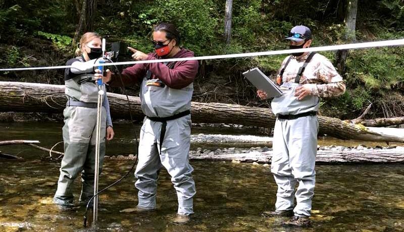
- Twinned Watersheds Project, lead by Cowichan Tribes and Halalt First Nation (and CWB in Phase I, 2022). In 2021-2022, this project had local field crews gathering previously unavailable data about water flows, fish habitat, and riverbank ecology. Experts then analyzed this data to understand the relationships between these elements and presented their findings to decision-makers and government staff. The project is ongoing, now conducting fish stock assessments.
Learn About Our Other Projects
 Email
Email