News Release, Outdoor Recreation Council of BC, March 17, 2016
The list highlights the Seymour, Fraser, Cowichan, Thompson, Peace and Skeena Rivers and Shawnigan Creek
 This year’s most endangered rivers list for British Columbia, compiled since 1993 by the 100,000 member Outdoor Recreation Council (ORC) and based on public input, details the province’s most imperiled rivers by region, including the Lower Mainland, Vancouver Island, the interior and the north.
In the Lower Mainland, the Seymour River has been impacted by a 50,000 cubic meter rock slide that occurred in December, 2014 and now blocks the return of key early coho and summer steelhead stocks. In addition, this blockage has had broader ecosystem impacts in that wildlife, such as bears, mink, otters and eagles are being severely impacted due to diminishing fish stocks. Last fall, under the admirable direction of the Seymour Salmonid Society, it took 2500 volunteer hours to net and hand-carry fish above the slide, an option that is not sustainable.
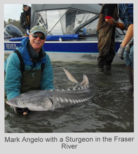
A proposal to restore the river has now been put forward. This entails a 2 to 5 year plan to recreate an access channel for fish through the slide area using low velocity explosives. This would cost about $200,000 per year and total expenditures could approach or slightly exceed 1 million dollars if the full 5 years is required. “Given the importance and uniqueness of the Seymour’s coho and steelhead stocks in the Lower Mainland, everything possible must be done to mitigate the impacts of the slide”, said Mark Angelo, ORC Rivers Chair and well known river advocate, “and both the Province and the DFO should be major financial contributors and partners in the effort”.
Sharing top spot on the endangered list for the lower mainland, but spanning multiple regions as well, is the Fraser River. While facing numerous development and industrial pressures along with urbanization and pollution, the Fraser is also confronted with pressures associated with climate change. Last summer, the river was especially warm. “Of particular concern, said Angelo, is that changing climatic conditions could push more and more native species northward over time”. In support of this, recent studies have indicated that aboriginal fish catches could diminish by up to 50 per cent by 2050 as marine species move up the coast in search of cooler waters.
Along the Fraser’s most urban stretch, there is also a major need for a comprehensive environmental sustainability plan that better assesses the cumulative effects of the many major development projects now occurring in the Fraser River estuary. Further upriver, there is also a need for a collaborative plan aimed at protecting key habitats along the river’s most productive stretch between the towns of Hope and Mission; a stretch known as the Heart of the Fraser.
The most endangered waterway on Vancouver Island is the Cowichan, one of the finest sports fishing rivers in BC, which flows from Cowichan Lake to its mouth at Cowichan Bay not far from the town of Duncan. As a result of the drought-like conditions that persisted through much of 2015, the river suffered from extremely low flows and high river temperatures for much of the summer months. This, in turn, had a serious impact on the health of the river’s ecosystem and its salmon and trout stocks. “The circumstances that have unfolded on the Cowichan highlight the need to more proactively address the impacts of climate change”, said Angelo, an Order of BC and Order of Canada recipient for his river conservation efforts. In the case of the Cowichan, there is an opportunity to take positive action in that a weir currently exists at the river’s outlet which holds back water so that a steady supply can be provided to the Catalyst Paper mill in nearby Crofton. “If the weir was nominally raised, which the ORC supports”, said Angelo, “water spillage from the lake would be lessened in winter allowing for more water to be held back and dispensed to the river in summer months, which would increase flows and lessen water temperatures”.
Also endangered on Vancouver Island is Shawnigan Creek, which sustains a significant Coho salmon run while also playing a vital role in providing brood stock when needed for the Goldstream River. In 2013, South Island Aggregates received a 50 year permit to place up to 100,000 tons of contaminated soil annually at a location close to the upper creek. This poses a potential risk to the creek and its fish stocks, while also jeopardizing the drinking water of Shawnigan Lake that nearby residents depend upon. “We must take a more precautionary approach to protecting our waterways. Facilities such as contaminated soil dumps should not be located close to rivers”, said Angelo.
Moving to the interior, the Thompson River is considered endangered as well. A major reason centers on the state of the river’s internationally renowned steelhead run. These fish are considered “an extreme conservation concern” and their precarious state highlights the need for a more precautionary and selective approach to the overall salmon fishery. The Thompson steelhead run, which now numbers just over 400 fish, requires dramatic action including the development of a comprehensive recovery program. In addition, water licences and water extraction rates on various tributaries must be more closely monitored to ensure adequate flows remain for fish. There are also increasing concerns being expressed about industrial development proposals such as the Ajax mine in Kamloops.
In the province’s northern region, the Peace River near Fort St. John once again finds its way onto the endangered rivers list. The Peace is threatened by a third major dam, now under construction, which will flood more than 80 km of the last largely natural stretch of this waterway. The dam continues to be challenged by local First Nations. Also in the north, in the Skeena Estuary, fisheries scientists, conservationists and First Nations have expressed great concern that eelgrass beds on Flora Bank, which provide essential salmon rearing habitat, would be damaged by a proposed LNG terminal.
As one scans the rivers that are profiled this year, it’s important to note that this list is not meant to be all-inclusive and there are clearly other rivers that ORC will continue to follow. But this year’s list focuses on those river issues deemed most pressing at this point in time. “The endangered rivers release, now in its 23rd edition and released every two years, helps create a greater awareness of the many threats that confront our waterways”, said Angelo.
More information and backgrounder at https://orcbc.ca/pro_endangered.htm
For more information, contact: Jeremy McCall, ED, ORC, 604-873-5546, or Kelly Friday at 604-836-6700