We want seasonal flows throughout the Cowichan-Koksilah watershed to support the needs of communities and aquatic ecosystems.
Progress Indicators
[updated 2023]- Water reserves in Cowichan Lake would be managed such that the rate of flow into the Cowichan River meets the soft targets established in the Cowichan Water Use Plan (2018), delivering, at minimum, the following flow regime:
- March & April: 25 cubic meters/second
- May 1 - June 15: 15 cubic meters/second
- June 15 - arrival of fall rain: 7 cubic meters/second
- The Koksilah watershed would be managed so as to deliver rates of flow defined as required Environmental flows (E-flows) as per Water Sustainability Planning process currently underway.
Rationale
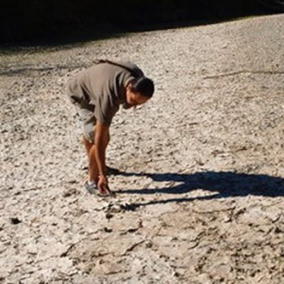
Adequate spring, summer and fall flows in the Cowichan River are essential to ensure a healthy ecosystem and healthy communities in the Cowichan Valley. However, natural water flows, once balanced by our climate, forests, and wetlands, have changed dramatically in 100 years. A reduced snowpack and less rainfall during the summer in recent years means that a new water strategy is required through increased lake water storage. According to recent climate studies by University of Victoria, average summer inflows at Cowichan Lake have declined by 35 per cent between 1955 and 2008 – and this trend is continuing and accelerating. Healthy flows benefit human communities providing jobs, through industries such as the Crofton mill; locally-grown food; an efficient way to dilute sewage effluent; and recreation and tourism activities, including swimming, kayaking and tubing. In addition, the river must maintain certain minimal levels of flow at various times of year for salmon and the aquatic ecosystem they depend on to thrive. A complex schedule of flows is needed by various fish species throughout the life cycle from egg to returning spawner. _________ [Last updated 2018. See Cowichan Weir and Koksilah Watershed Planning Project pages as well as our Drought Response webpage for current Flows updates ] Progress In 2016 the Fish and Flows Working Group convened an expert panel to consider optimal flow rates for fish health in the Cowichan River. This panel included representatives from Cowichan Tribes, federal and provincial governments, the BC Conservation Foundation and recreational fisheries. The year-long process, coordinated by biologist Cheri Ayers, set up a target flow model for the Cowichan River, referring to ideal conditions for salmon at all life stages, as well as indicating minimum flows, below which salmon health can be harmed. This foundational work supported the next step - a multi-stakeholder water use planning process for the Cowichan River, directed at developing a strategy to ensure sustainable spring and summer flows for future generations. This process was led by a steering committee with representation from CVRD, Catalyst, Cowichan Tribes and the CWB, and completed in the spring of 2018 with a consensus recommendation of increasing storage in Cowichan Lake by 70 centimeters. The CWB is now working with partners towards implementation of the recommendations of the Cowichan Water Use Plan by raising the weir at Cowichan Lake. This project is a collaboration, with support from all levels of Government either as financial supports or project partners. Please see the project website for current information here: cowichanlakeweir.ca In the Xwulqw'selu Sta'lo' (Koksilah River) watershed, which joins the Cowichan watershed at the estuary, the CWB also successfully engaged the province in monitoring extreme low summer flows to protect critical environmental flows, starting in 2018. The CWB facilitated efforts to support Koksilah watershed water users, particularly large farms, to continue to be profitable with more scarce water resources, including looking for incentives for investing in more efficient watering systems and/or increased water storage through an Environmental Farm Plan. Concern for the Xwulqw'selu grew as summer flows dropped, and in 2020, Cowichan Tribes and the Province of BC began scoping and planning for a Watershed Sustainability Plan to address water challenges in the Xwulqw'selu/ Koksilah watershed. For more on this, please visit the Xwulqw'selu Watershed Planning project website: koksilahwater.caMonitoring [ out of date - also see https://cowichanwatershedboard.ca/drought-response/]
River flows and lake levels in the Cowichan are closely monitored by a variety of partners. Catalyst Paper, who holds the water storage license associated with the weir, monitors lake levels, with the Water Survey of Canada operating two gauging stations on the river. There are also similar gauging stations on two of the major Cowichan Lake tributaries, Cottonwood creek and Shaw creek. During the spring, summer and fall months the information from these monitoring stations is presented and discussed weekly on a conference call hosted by Catalyst and attended by representatives from all levels of government, Cowichan Tribes, the CWB and stewardship organizations. Recommendations for flow adjustments generated from these conversations are forwarded to the water comptroller. In recent years however, there have been no “good solutions” to summer and fall flow concerns as there is simply not enough water. Increased monitoring efforts in the Koksilah River are also providing data to inform the tough water management decisions required to balance environmental needs with those of water users.Next Steps
- Please refer to project websites above for current information.
 Email
Email


